The community of Malakoff is located within the City of Ottawa, Ontario, Canada, on lots 6 and 7 of concession 6 in the historic township of Marlborough. Originally known as 'Windfall', Malakoff was named after the Malakhov Tower, one of the fortifications of Sevastopol during the Crimean War. The names of the communities of Kars and Inkerman in Eastern Ontario have a similar source.
Malakoff has no well defined boundaries. The long-closed United Church of Canada, which was originally Wesleyan Methodist, and the cemetery associated with it, are about 400 yards apart on the road which divides concession 6 from concession 7. On the road which divides concession 5 from concession 6, one mile distant from the church and cemetery, was the cheese factory, also long closed. Midway between the concession lines is a building in which the store and post office were operated many years ago. No longer is there a sign that identifies Malakoff's location. It exists only in the memories of those who were, and some who still are, it's residents.
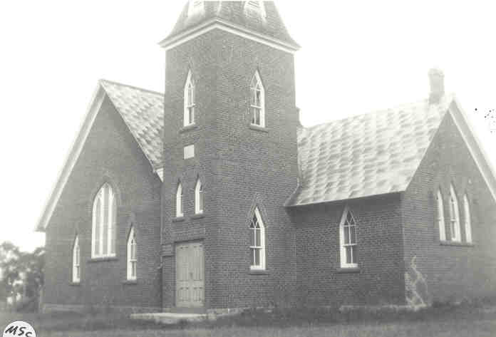
The Malakoff Wesleyan Methodist church traces back to the 1840's or 1850's.The original church was replaced with a brick building in 1892. In the course of construction, the old church was destroyed by fire. A local news report said that it had "...served its people well for about forty years". This is a view of the church built in 1892. This church was closed in the 1960's and now is used as a residence.
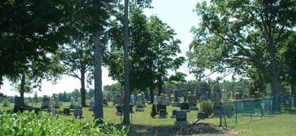
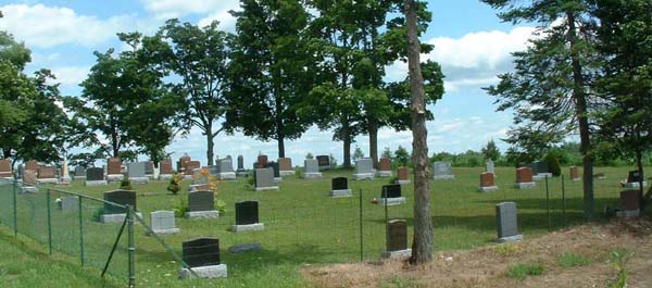
The Malakoff United Church cemetery is located on the northern end of lot 6, concession 6, Marlborough township. The farm on which it is located was settled by the Adam Johnston family, all emigrants from County Leitrim, Ireland in 1845. The gravestone with the earliest date of burial is that of Adam Johnston in 1863. The wife of Adam's oldest son died in 1861 and was buried elsewhere indicating clearly that the cemetery had not existed then. It was not until 1885 that the church officers resolved to obtain a deed for the graveyard and to fence it. The fence was to be built of four wires, posts eight feet apart and three feet in the ground, a double gate to be painted and a stile to be erected at the side of the gate. In 1887 the officers authorized John Hill to plant trees around the graveyard. In the early 1900's the cemetery was extended to the west and at that time the trees on that side were removed. At this time (2007) many of the trees have died and those that remain are in their final stages. After 2000 there was an extension to the south. This is a view of the cemetery from the east; this is a view from the west.
For each gravestone, the part of the inscription that has genealogical value, but not necessarily all of the inscription, has been transcribed. Although generally only the front view of the gravestone is displayed, all of the faces of the gravestones have been photographed and the inscriptions on all of the faces have been transcribed.
Two alphabetic indexes are provided, a Primary Names list and a Secondary Names list. In creating the lists, for each gravestone a single name has been arbitrarily selected as a 'Primary Name'. The remainder of the names on the gravestone are regarded as 'Secondary Names'. These have been arranged in alphabetical order to enable any name in the cemetery to be located conveniently.
Not all of the gravestones in the cemetery are represented on this website. Those that have been excluded include
There are approximately 130 photographs. Associated with each photograph there is a brief commentary intended to fit the person(s) into a family group. Click on this link to access the photographs. Photographs